Village evacuation after the Kyshtym disaster in the Soviet Union
A historical reconstruction of a rural Soviet community being evacuated after radioactive contamination associated with the Mayak disaster.

Kyshtym Disaster: Villages Erased From Soviet Maps

Posted on
Share this story

Why Did an Entire Village Disappear From Soviet Maps?

In the southern Urals, villages once stood along rivers, roads and fields that had supported farming communities for generations. After the Soviet Union built the Mayak nuclear complex in the late 1940s, radioactive contamination transformed parts of that landscape, first through routine waste discharges and later through the catastrophic explosion of a radioactive-waste tank on September 29, 1957. Decades later, researchers examining the region reported that approximately 30 small villages near the contaminated area had disappeared from Soviet maps after 1958, creating one of the strangest cartographic legacies of the Cold War.

The phrase “disappeared from Soviet maps” can make the story sound like a single village simply vanished overnight. The historical reality is more complicated and, in some ways, more disturbing. Several settlements were physically evacuated and later dismantled or abandoned, while others remained inhabited for years despite contamination, and the available evidence does not establish that every missing settlement was erased from every map through a single centralized order.

What is clear is that the Soviet nuclear program created a geography in which places could become difficult or impossible to acknowledge publicly. Mayak itself operated in extraordinary secrecy, and the nearby closed city of Chelyabinsk-40 was deliberately isolated from ordinary Soviet geography. The radioactive landscape around it added another layer of concealment because acknowledging contamination would also have meant acknowledging what the weapons program had done to the surrounding population and environment.

The result was not just an environmental disaster.

It was a transformation of the map.

The Secret City at the Center of the Story

The place now known as Ozyorsk began as a secret Soviet nuclear city. During the late 1940s, the Soviet Union urgently needed its own plutonium production capability for the emerging atomic weapons program, and a heavily guarded complex was constructed in the southern Urals. The nuclear installation became known as Mayak, while the associated city was identified publicly through the coded designation Chelyabinsk-40 and later Chelyabinsk-65 rather than its actual location.

Secrecy was built into the city’s existence. Workers and scientists were moved into a closed environment, access was restricted, and the city did not function like an ordinary Soviet municipality visible on public maps. Historical research into Mayak describes the complex as one of the most secretive places in the Soviet Union, while contemporary accounts of the closed city emphasize the extraordinary restrictions placed on its inhabitants during the early years.

The secrecy had a strategic purpose. The Soviet leadership wanted to conceal the country’s ability to manufacture weapons-grade plutonium from foreign intelligence services, particularly the United States, and the remote location of the complex made the southern Urals attractive. The geography was not chosen merely for isolation from Western spies; the region also offered rivers, forests and a relatively sparse population that could be incorporated into the secret military-industrial landscape.

The surrounding rural population, however, already lived there.

That created the contradiction at the heart of the entire story.

A secret nuclear weapons complex had been placed inside an existing human landscape.

Before the Explosion, the River Was Already Contaminated

The 1957 explosion was the event that eventually gave the disaster its name, but it was not the beginning of environmental contamination at Mayak. From the earliest years of the facility’s operation, radioactive waste was discharged into nearby water systems, including the Techa River, whose villages depended on the river for everyday needs. Academic research describes roughly 40 villages along the Techa during the early period, with about 28,000 inhabitants collectively and many communities relying on the river for water.

For residents, the river was not an abstract environmental feature. It was part of ordinary life, providing water for drinking, washing, fishing, livestock and agriculture. That meant radioactive waste entering the river was not confined to an industrial compound; it became part of the environment through which villagers lived. Later studies found that exposure pathways included external radiation and, significantly, internal exposure from consuming contaminated food.

The Soviet authorities did eventually begin relocating some communities along the Techa, but the process was gradual and extended over many years. Government records published after the Soviet period identify numerous settlements whose inhabitants were evacuated between 1949 and 1962 as a result of radioactive discharges into the river and contamination associated with the Mayak operation.

This is an important distinction because it changes the way the 1957 disaster should be understood. The explosion was catastrophic, but it occurred within an environmental crisis that had already been developing for years. In some communities, contamination and relocation were not a single sudden event but an unfolding process that changed where people could live, work and farm.

September 29, 1957

The explosion occurred at the Mayak facility on September 29, 1957. A storage tank containing highly radioactive liquid waste experienced a failure in its cooling system, allowing the material inside to heat until a powerful chemical explosion destroyed the tank and dispersed radioactive substances into the environment. The United Nations Scientific Committee on the Effects of Atomic Radiation estimates that approximately 90 percent of the released activity was deposited within five kilometers of the explosion, while the remainder was carried into the atmosphere and produced the East Urals Radioactive Trace.

The contamination footprint was enormous. UNSCEAR reports that deposition above 3.7 kBq per square meter extended across approximately 23,000 square kilometers and included 217 settlements with a combined population of about 270,000 people. The most heavily contaminated settlements were evacuated rapidly, followed by additional relocations over subsequent months as authorities responded to radiation levels.

The timeline matters because the disaster did not produce one neat evacuation line. Different communities experienced different levels of contamination and different decisions about relocation, and some residents were moved quickly while others remained in contaminated areas for considerably longer. An IAEA publication summarizes the total population relocated after the Kyshtym accident at roughly 12,000, although exact totals vary with the period and definition used.

For a government obsessed with secrecy, the event presented an enormous political problem. A visible nuclear accident would have revealed the existence and operation of a weapons-production complex that officially barely existed on the public map, while admitting the scale of contamination would have exposed the consequences for surrounding communities. The logic of secrecy therefore extended beyond the reactor or production buildings into the landscape itself.

What Happened to the Villages?

The answer was different from place to place.

Some settlements were evacuated and their populations resettled elsewhere. Government documents from the post-Soviet period identify a long list of communities in the Chelyabinsk and Sverdlovsk regions whose residents were relocated during 1957–1960 because of contamination from the accident. The list includes places such as Metlino, Alabuga, Berdyanish, Boevka, Zamanikha, Satlykovo and others.

Other communities were affected by the earlier and continuing contamination of the Techa River. Those relocations followed a different chronology, stretching from the late 1940s into the early 1960s. In official Russian documentation, the two processes are distinguished: one category concerns settlements affected by the 1957 accident, while another includes settlements affected by radioactive discharges into the Techa River.

The physical disappearance of some villages was therefore the end of a longer administrative process. Residents left, houses and infrastructure could be dismantled or abandoned, access restrictions changed the use of the land, and eventually there might be little reason for a settlement to appear on an ordinary public map. A later academic study of “disappeared villages” in the southern Urals describes how the original communities lost not only their physical homes but also elements of their local culture and historical identity after resettlement.

That is why “vanished” can be a misleading word if it suggests a supernatural disappearance.

The villages did not evaporate.

Their residents were moved.

The settlements then ceased to function as ordinary communities.

Their names became administrative remnants, historical references or, in some cases, absences on maps.

Did the Soviet Government Really Erase Them From Maps?

Soviet map showing the hidden geography around the Mayak nuclear complex
An interpretive reconstruction of Cold War-era Soviet cartographic secrecy surrounding the Mayak nuclear complex.

This is where the evidence requires care.

A 1980 Oak Ridge National Laboratory report reviewing information about the Kyshtym disaster cited earlier research by Trabalkа and colleagues stating that approximately 30 small villages near the contaminated area disappeared from Soviet maps after 1958. The same report warned that some information about Soviet countermeasures was based on published literature, speculation or hearsay and emphasized that many details remained uncertain because the Soviet government had not released a complete accounting.

That qualification is important.

There is strong evidence for the disappearance of settlements from the inhabited landscape and for restrictions around contaminated territories. There is also documentary evidence that a number of villages were officially evacuated and that the Soviet nuclear complex itself operated in a highly secret geographic environment. What is harder to establish is a single documented Soviet directive saying, in effect, “remove these specific villages from every map.”

The phrase nevertheless has a factual foundation because cartography in the Soviet Union was not simply a neutral public record. Sensitive military installations, closed cities and strategically important facilities could be omitted, distorted or represented through restricted map systems. Mayak itself was not shown on Soviet public maps, and its associated city existed under a coded designation.

That means map disappearance should be understood as part of a larger information-control system rather than as an isolated act of cartographic vandalism.

The map reflected what the state was willing to let ordinary citizens know.

A Landscape That Could Not Be Allowed to Speak

A village can disappear from a map without disappearing from memory.

For people who lived there, the name of a settlement could remain attached to family stories, burial places, fields, churches, rivers and memories of childhood. Academic fieldwork in the southern Urals has documented precisely this problem: researchers studying disappeared villages found communities whose original populations had been resettled elsewhere while elements of their former cultural identity survived in the new locations.

The map, meanwhile, served a different purpose.

A map tells travelers where roads go, where settlements begin and where ordinary life is expected to exist. Removing a settlement from that system can make a place harder to find, visit or discuss. If the surrounding territory is also restricted, contaminated or guarded, cartographic absence becomes practical rather than symbolic.

This is one reason the history of the Kyshtym region is so different from the history of an ordinary abandoned village. A community abandoned because of economic decline might remain visible as a ruin that people can visit freely. A village affected by the Mayak system could be absent not only because nobody lived there anymore, but because the state had reasons to control access to the landscape and information about it.

The missing village therefore existed in two different forms.

On the ground, it could be empty.

On the map, it could be absent.

In memory, it could still be alive.

The East Urals Radioactive Trace

The contaminated landscape created by the 1957 accident became known as the East Urals Radioactive Trace, or EURT. UNSCEAR estimates that the area receiving deposition above its specified threshold extended over approximately 23,000 square kilometers, creating one of the largest contaminated territories associated with a civilian or military nuclear accident.

The trace did not form a perfect circle around Mayak. Its shape reflected atmospheric transport, weather conditions and the direction of the radioactive plume after the explosion. Maps of the contaminated area show a long, irregular zone stretching away from the plant through a landscape containing numerous settlements and waterways.

For residents, contamination did not end when the initial radioactive cloud moved away.

Long-lived radionuclides remained in soil and ecosystems.

Food became an important exposure pathway.

Rivers and wetlands remained contaminated.

Land use was restricted in some areas.

And decisions about relocation continued for years. UNSCEAR notes that external exposure dominated during the first months after the accident, while ingestion of strontium-90 through locally produced food became increasingly important later.

This explains why some communities could not simply be evacuated for a few weeks and then reopened.

The danger had become embedded in the environment.

Metlino, Muslyumovo and the Villages Along the Techa

The names of particular settlements help make the scale of the disaster more tangible.

Metlino was one of the villages in the contaminated region, while Muslyumovo became one of the most significant communities along the Techa River. Later government documentation specifically recognized Muslyumovo as a settlement where annual effective radiation doses exceeded the threshold used in Russian social-protection legislation.

Muslyumovo is important because its history does not fit the simple story of a village that vanished immediately after 1957.

The settlement survived for decades.

Its population lived with the legacy of the contaminated river.

Eventually, a major resettlement program began in 2006, illustrating how long the consequences of the Mayak environmental disaster continued beyond the original accident. Contemporary Russian reporting described the relocation as an effort to address longstanding ecological problems along the Techa.

This complicates the popular image of “the missing Soviet village.”

Some communities disappeared soon after contamination.

Some were dismantled.

Some were resettled gradually.

Some remained inhabited long after the disaster.

The map was changing over decades, not hours.

Secrecy Made the Human Cost Harder to Measure

The Soviet Union eventually acknowledged aspects of the 1957 accident, but the full story remained concealed for decades. The secrecy surrounding Mayak meant that residents of affected regions and outsiders had limited access to reliable information about what had happened, while Western intelligence agencies tried to reconstruct the events through reports, satellite imagery and other sources.

Declassified satellite imagery became particularly important because the landscape itself could reveal changes that official statements did not. Research using declassified reconnaissance photographs has examined evidence of radioactive contamination, industrial activity and environmental transformations around the Mayak complex, demonstrating how Cold War satellite intelligence eventually became an archaeological and historical source.

That is an extraordinary reversal.

The Soviet state tried to hide the landscape.

Decades later, historians study old surveillance photographs to reconstruct it.

The same geography that had been concealed for national-security reasons became evidence of the concealment itself.

Why Was Kyshtym Used as the Name?

The disaster is usually called the Kyshtym disaster even though the explosion did not occur in the town of Kyshtym.

The reason is itself a consequence of secrecy.

The Mayak complex was located near the closed city of Chelyabinsk-40, an officially restricted nuclear settlement whose real identity and location were concealed. Kyshtym was a recognized nearby town and therefore became the geographic reference that could be used publicly without directly naming the secret facility.

In other words, even the disaster’s name carries the imprint of Cold War secrecy.

Calling it “Kyshtym” allowed outsiders to discuss the event using a real place while avoiding the name of the closed nuclear city at its center.

This also explains why historical accounts can seem geographically confusing. There is Kyshtym, the nearby ordinary town; Chelyabinsk-40, the secret city later known as Ozyorsk; Mayak, the nuclear complex; the Techa River and its villages; and the vast East Urals Radioactive Trace created by the accident.

The map had several layers.

Some were public.

Others were restricted.

Some were radioactive.

And some were deliberately difficult to see.

The Villages Were Not the Only Things Hidden

The disappearing settlements were part of a broader system of concealment.

Mayak’s buildings, waste facilities and closed city were connected to a secret weapons program that the Soviet government had strong reasons to protect. Even ordinary residents inside the closed city lived under restrictions that separated them from the rest of Soviet society. Contemporary reporting on Ozyorsk describes residents being prevented from leaving freely and even restricting correspondence during the city’s earliest years.

Environmental contamination created a second secrecy problem because revealing the condition of the surrounding landscape could expose the consequences of the nuclear program.

This is why the story resembles the history of other hidden Soviet places, but with an important difference. The villages were not built as secret military settlements; they were ordinary communities that became entangled with a secret industrial system operating nearby. Their disappearance was therefore imposed on an existing civilian landscape rather than designed from the beginning.

The result was a geography in which residents could live surprisingly close to a facility whose existence was barely acknowledged publicly.

That arrangement could work only as long as information remained tightly controlled.

The accident exposed the weakness of that system.

What the Soviet Government Could Not Erase

Even when buildings disappeared, evidence remained elsewhere, government relocation lists survived, scientific measurements survived, family memories survived, declassified intelligence documents survived, aerial photographs survived, environmental contamination survived. And the landscape itself remained available for later scientific investigation. The IAEA and UNSCEAR have since reconstructed the scale of the radioactive contamination and population movements using data unavailable to the public during the Soviet period.

This is why the story of the disappeared villages is not simply about Soviet propaganda, it is also about the limits of state secrecy. A government can control what appears on a public map, but it cannot easily control every trace left by a contaminated river, an evacuated population or a changed landscape. The vanished place can return through documents. It can return through oral history, it can return through archaeology, it can return through satellite imagery, in that sense, the missing villages eventually became visible in another kind of map: the historical record.

What Became of the People?

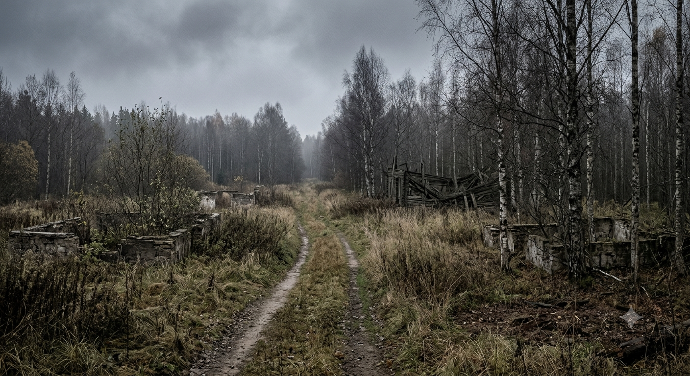
Abandoned Soviet village affected by the Mayak radioactive trace
A historical reconstruction of the kind of rural landscape transformed by evacuation and abandonment in the southern Urals.

A vanished settlement is easy to imagine as an empty collection of abandoned buildings, but the people are more important than the buildings.

When Soviet authorities relocated residents, families had to establish new lives elsewhere. Some communities were resettled together, preserving elements of their social organization, while in other cases people were dispersed into already existing settlements. Research on the cultural history of the disappeared villages emphasizes that relocation could break longstanding relationships between families, land and local traditions.

The psychological consequences were also complicated by incomplete information.

Residents did not necessarily receive a full explanation of the hazards they faced.

The Soviet secrecy system could mean that people knew something was wrong without understanding the radioactive nature of the danger or its long-term implications. This transformed relocation into more than a change of address; it could mean losing a familiar landscape without being given a clear account of why that loss was necessary.

This is one reason historians increasingly treat the Mayak disaster as a social and cultural catastrophe, not simply a radiation event.

The destroyed or abandoned village was only the visible part.

The displaced community was the deeper loss.

Why the Story Still Matters

The disappearance of villages from Soviet maps is sometimes presented as a sinister Cold War mystery, as though the settlements vanished through unexplained government magic. The actual history is stranger because it is more mundane. A government built a secret nuclear complex. Waste was released into the environment, a major radioactive accident occurred, people were relocated, restricted areas were created. Some settlements ceased to exist as functioning communities. And historical evidence suggests that dozens of small villages near the contaminated area later disappeared from Soviet maps. Nothing supernatural is required.

The mystery lies in how long the process remained hidden. The Kyshtym disaster did not create an empty landscape overnight. It created a chain of administrative decisions that gradually separated people from places, places from maps and maps from the reality on the ground. The disappearance was therefore bureaucratic as well as physical.

The same pattern appears in other abandoned settlements, although for very different reasons. HiddenFrontiers’ account of Pripyat’s transformation after Chernobyl shows what happens when an entire modern city is evacuated after a nuclear disaster, while the site’s article on the world’s isolated villages provides a useful contrast: those communities remain visible precisely because their continued existence is part of the geography rather than something a government needed to conceal. The southern Urals present the darker version of the story. A place can disappear because everyone leaves. But it can also disappear because the state decides that acknowledging the place is inconvenient.

What We Know

The Mayak nuclear complex was established in the southern Urals during the Soviet atomic weapons program, alongside the closed city of Chelyabinsk-40, later known as Ozyorsk. The complex and city operated under extraordinary secrecy, and Mayak was not shown on ordinary Soviet public maps.

Radioactive waste was discharged into the Techa River during the early years of Mayak’s operation, exposing communities along the river before the 1957 explosion. On September 29, 1957, a radioactive-waste storage tank exploded after failure of its cooling system, producing the East Urals Radioactive Trace.

UNSCEAR estimates that the contaminated area receiving deposition above 3.7 kBq per square meter extended to about 23,000 square kilometers and included 217 settlements with approximately 270,000 people. Thousands of residents were subsequently relocated from highly contaminated settlements and additional communities over the following months and years.

Official Russian documentation lists numerous settlements evacuated after the 1957 accident, while separate records identify villages relocated because of radioactive discharges into the Techa River. The lists demonstrate that the disappearance of settlements was real, even though the timing and cause differed from village to village.

What Remains Uncertain

The strongest claim about villages “disappearing from Soviet maps” comes from historical analyses that cited earlier research reporting approximately 30 small villages removed from Soviet maps after 1958. The Oak Ridge report that preserves this claim also explicitly warns that some information about Soviet countermeasures was based on speculation, published Soviet literature or hearsay, and that the full Soviet accounting was not available.

For that reason, it would be inaccurate to state that a single secret order has been discovered instructing officials to erase exactly 30 villages from every Soviet map. The evidence supports a broader interpretation in which settlements were evacuated, dismantled, restricted and eventually omitted from public geographic representation, but the documentary record does not establish one universal mechanism for every missing village.

The exact number of communities affected by the wider Mayak contamination also depends on the definition being used. UNSCEAR’s 217 settlements refers to the area receiving specified levels of deposition from the 1957 accident, while other sources discuss villages affected by earlier Techa River discharges, producing larger or differently defined totals.

This uncertainty does not weaken the central historical fact. It makes the story more precise.

FAQ

Did a village really disappear from Soviet maps?

Yes, historical research has reported that approximately 30 small villages near the contaminated area disappeared from Soviet maps after 1958. However, the evidence does not establish that every village was removed through one documented central order, and the details of the process remain uncertain.

What was the Kyshtym disaster?

The Kyshtym disaster was a major radioactive accident at the Mayak nuclear complex on September 29, 1957. A storage tank containing highly radioactive liquid waste exploded after a cooling-system failure, spreading radioactive material across a large area of the southern Urals.

Where did the Kyshtym disaster happen?

The explosion occurred at the secret Mayak complex near the closed city of Chelyabinsk-40, now Ozyorsk, rather than inside the town of Kyshtym itself. The disaster became known as Kyshtym because Kyshtym was the nearest recognized town that could be publicly named.

Why were Soviet villages evacuated?

Villages were evacuated because radioactive contamination from the Mayak accident and earlier waste discharges made continued residence unsafe in some areas. Official records distinguish settlements evacuated after the 1957 accident from those relocated because of earlier contamination of the Techa River.

What happened to the Techa River?

The Techa River received radioactive waste from the Mayak complex during the early years of its operation, contaminating the river and exposing downstream communities. Later radiation studies identified both external exposure and internal exposure through contaminated local food as important pathways.

Is the region still radioactive?

Some contaminated areas remain subject to radiation controls and remediation. The long-lived radionuclide strontium-90 was particularly important to the long-term radiation risk, and international assessments continue to monitor the legacy of the Mayak contamination.

Was Mayak itself shown on Soviet maps?

Mayak was a highly secret Soviet nuclear complex, and sources on its history state that the facility was not shown on ordinary Soviet public maps. The associated closed city was identified through coded names such as Chelyabinsk-40 and Chelyabinsk-65.

Are the vanished villages completely gone today?

Not necessarily. Some were dismantled or abandoned, while others survive in altered form, or their former residents were resettled elsewhere. Academic research into “disappeared villages” shows that the communities themselves sometimes survive through descendants, memory and cultural practices even when the original settlement no longer functions..


SOURCES & REFERENCES

United Nations Scientific Committee on the Effects of Atomic Radiation — UNSCEAR 2024 Report, Volume II.
Used for the September 29, 1957 accident, radioactive release, East Urals Radioactive Trace, affected settlements, population figures and exposure pathways.
https://www.unscear.org/unscear/uploads/documents/unscear-reports/UNSCEAR_2024_Report.Vol.II.pdf

International Atomic Energy Agency — Remediation of Contaminated Environments: Description of Case Studies, Technical Reports Series No. 475.
Used for the Mayak accident, East Urals Radioactive Trace and long-term remediation context.
https://www-pub.iaea.org/MTCD/Publications/PDF/trs475_web.pdf

Oak Ridge National Laboratory — ORNL-6146, An Analysis of the Alleged Kyshtym Disaster.
Used for the historical claim that approximately 30 small villages disappeared from Soviet maps after 1958, together with the report’s warnings about evidentiary limitations and incomplete Soviet records.
https://www.osti.gov/servlets/purl/7148724

Grzegorz Kiarszys — “A Nuclear Generator of Clouds: Accidents and Radioactive Contamination Identified on Declassified Satellite Photographs in the Mayak Chemical Combine, Southern Urals.” Cambridge Archaeological Journal, 2021.
Used for Mayak’s secrecy, the role of declassified satellite imagery and the archaeological interpretation of the nuclear landscape.
https://www.cambridge.org/core/journals/cambridge-archaeological-journal/article/abs/nuclear-generator-of-clouds-accidents-and-radioactive-contamination-identified-on-declassified-satellite-photographs-in-the-mayak-chemical-combine-southern-urals/87633029B9FA1A1154814477B1C11DA7

Tatyana V. Saveleva & Natalia B. Danilenko — “Atomic Atlantis: Ethnography of Settled Villages.” Südosteuropa, 2023.
Used for the cultural consequences of village resettlement and the history of disappeared Ural communities.
https://www.degruyterbrill.com/document/doi/10.1515/soeu-2021-0062/html

Government of the Russian Federation — Decree No. 1005, October 8, 1993.
Used to verify the official lists of settlements affected by the 1957 Mayak accident and Techa River radioactive discharges and the chronology of evacuations.
https://www.consultant.ru/document/cons_doc_LAW_93234/

Government of the Russian Federation — Order No. 430-r, April 4, 1994.
Used for the official recognition of Muslyumovo as a settlement with an annual effective radiation dose exceeding the applicable threshold.
https://base.garant.ru/6307193/

David R. Marples / Soviet nuclear geography and Mayak-related historical literature.
Used as contextual support for the closed-city and Soviet secrecy framework, supplemented by the academic and archival sources above.


Share this story
Gravatar Image
Hidden Frontiers Editorial Team researches and prepares stories about history, mysteries, ancient civilizations, historical places, and true crime. Hidden Frontiers uses AI-assisted tools for research organization, drafting, editing assistance, visual development, and historical reconstruction. Published material is reviewed and refined with attention to accuracy, context, sourcing, and historical uncertainty. Some images are AI-generated or AI-assisted reconstructions created for illustrative and educational purposes. They should not be interpreted as original historical photographs unless explicitly identified as such.

1 comment

Leave a Reply

Your email address will not be published. Required fields are marked *