Ancient cities could be difficult places for an invading army to enter, cross and control, but the reason was not always as simple as deliberately turning streets into a maze. Some settlements developed irregular streets because they followed hills, older property boundaries, natural terrain or centuries of construction, while others incorporated gates, angled approaches, narrow passages and elevated routes that clearly served defensive purposes. The idea behind ancient cities designed to confuse invaders has one particularly strong piece of evidence: Aristotle himself observed that irregular urban arrangements could make it harder for foreign troops to enter a city and find their way around during an attack. Perseus Digital Library
AI & Editorial Note
Hidden Frontiers uses AI-assisted tools as part of its content-production workflow, including research organization, drafting assistance, and visual development. The factual content of this article is strictly grounded in verified, cited sources, and disputed or uncertain information is identified where appropriate. Visuals accompanying this article are AI-generated historical reconstructions created for illustrative purposes.
The City Was Part of the Defense
A fortified city was more than a collection of walls surrounding houses. Its defensive system could extend from the landscape outside the settlement to the streets, gates, courtyards and elevated positions inside it. An attacker who successfully crossed a wall still had to move through a built environment controlled by defenders, and the arrangement of that environment could determine how quickly troops could advance and how effectively they could maintain formation. Ancient military architecture therefore treated access as a problem to be controlled rather than simply an opening to be closed. RCNi Company Limited
The distinction between a difficult city and a deliberately confusing one is important. Archaeologists frequently find irregular streets in ancient settlements, but irregularity alone does not prove military intention because cities grew incrementally and often adapted themselves to terrain. A road might bend because it followed a slope, an earlier wall, a property boundary or a preexisting route that had become too established to replace. The strongest cases for deliberate defensive planning come when awkward movement is combined with gates, walls, turns, elevation changes or other features that make an attack physically slower and more exposed. Cambridge University Press
This is why the most revealing evidence often comes from the points where an attacker had to enter. A city could allow its own inhabitants to move efficiently through familiar routes while forcing outsiders to pass through controlled gates and restricted approaches. Once an army entered such a system, its numerical advantage could become less useful if only a small number of soldiers could pass through a particular opening at one time. The architecture did not have to be a perfect maze to create that effect.
Aristotle Described the Strategy
One of the clearest ancient discussions of confusing urban design comes not from an archaeological excavation but from Aristotle’s Politics. Writing about the organization of a city, Aristotle contrasted regular straight streets with the less orderly arrangements he associated with older cities. His explanation was remarkably direct: a more irregular plan could make it difficult for foreign troops to enter and find their way around while attacking. Perseus Digital Library
Aristotle did not recommend making the entire city chaotic. Instead, he suggested combining the advantages of different arrangements, allowing some areas to have orderly streets while using less regular planning elsewhere for security. His argument reveals that ancient thinkers could understand urban space in explicitly military terms. The shape of streets was not merely a matter of convenience or beauty; it could affect how an enemy moved through the settlement. Perseus Digital Library
That observation also gives historians an important warning. It would be tempting to look at every ancient city with crooked streets and declare that its inhabitants intentionally designed the layout to confuse invaders. Aristotle’s statement does not justify that conclusion. It demonstrates that irregular urban planning could be understood as useful in war, but each archaeological site still has to be examined on its own evidence.
Why Straight Streets Could Be a Problem
A regular grid has obvious advantages for residents. Streets that intersect predictably make navigation easier, simplify the division of property and can facilitate movement of goods and people. These benefits help explain why highly ordered urban plans appeared in many ancient cities, particularly in Greek and Hellenistic contexts. The so-called Hippodamian tradition became associated with geometric planning, although modern scholarship cautions against treating Hippodamus of Miletus as the inventor of every ancient grid plan. MIT Press Open Arch & Urban Studies
The same regularity that helped inhabitants could also help an attacker. An army entering through a straight avenue could maintain direction, move supplies and communicate more easily with troops behind it. If important parts of a city were arranged along obvious axes, an invading force could potentially identify its route toward the political or administrative center. Regularity therefore had logistical advantages that were not necessarily compatible with every defensive situation. Perseus Digital Library
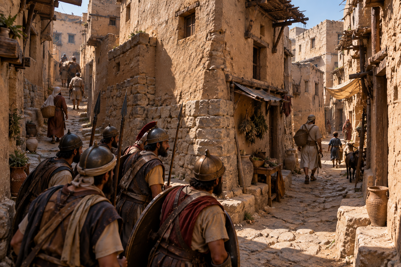
An irregular street system created a different tactical environment. A column moving through narrow turns could lose cohesion, while soldiers unfamiliar with the city might have difficulty knowing which route led toward the center, the walls or an exit. Defenders who knew the settlement could exploit that familiarity, particularly if elevated positions, barricades or fortified buildings controlled key junctions. The advantage came not from making the city incomprehensible but from making movement predictable for residents and uncertain for outsiders.
Gordion Shows How a Gate Could Control Movement
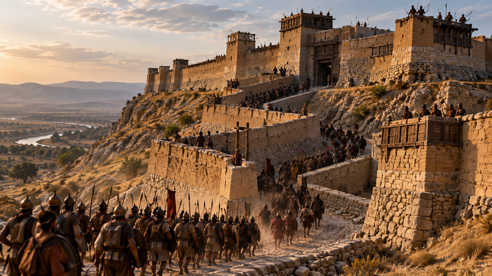
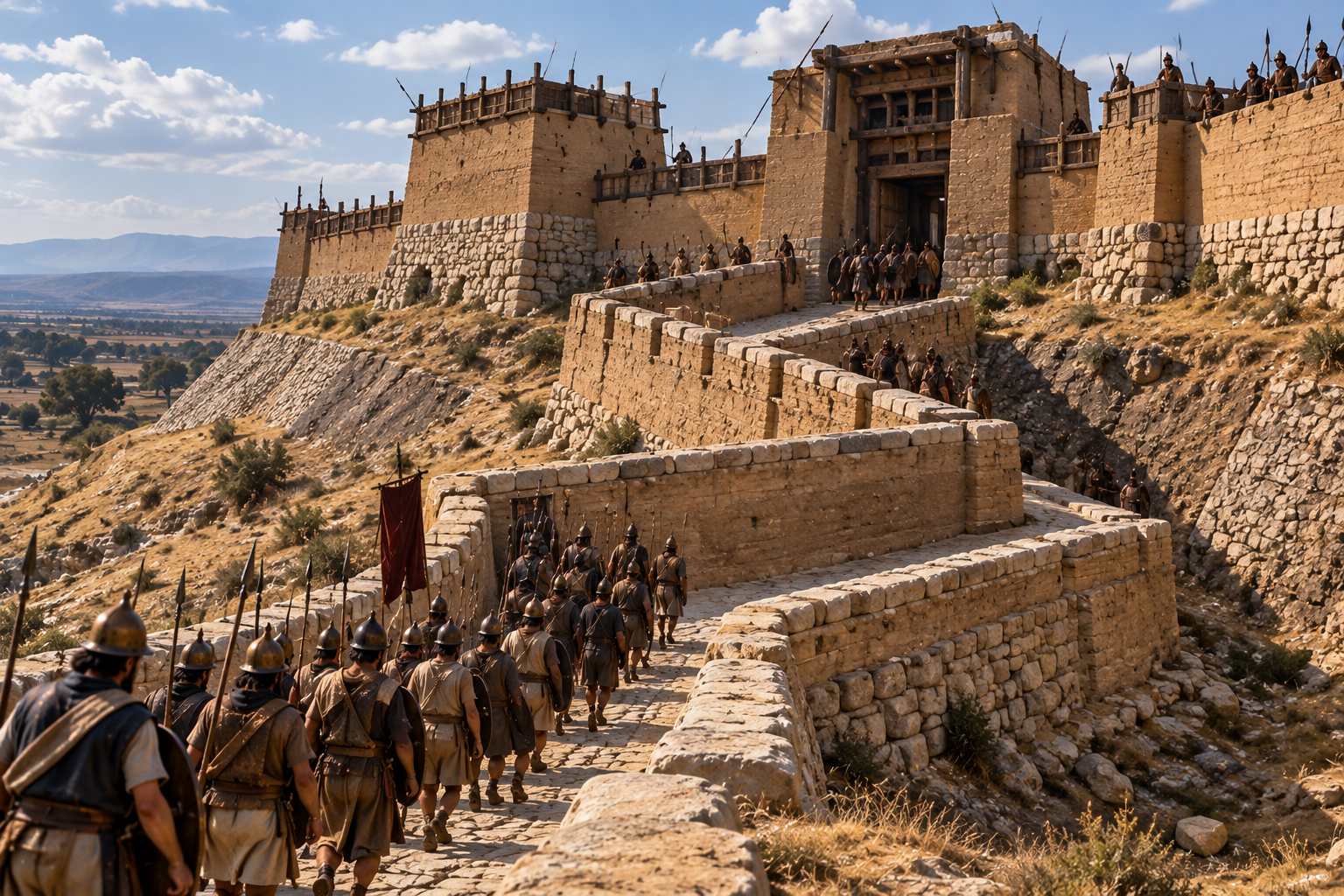
The ancient Phrygian settlement of Gordion in central Anatolia provides unusually clear archaeological evidence for defensive movement control. Excavations at the citadel have revealed massive fortification systems and gates associated with different phases of the settlement’s development. One of the most striking discoveries is the South Gate, whose approach road contained two significant angled turns before reaching the gatehouse. Archaeologists working at the site have concluded that these turns were intended to slow the advance of an attacking force. RCNi Company Limited
The physical arrangement made the approach more than a simple road leading directly toward an entrance. The route extended for approximately 94 meters and incorporated changes in direction as it climbed toward the citadel. Defensive walls and a substantial glacis further constrained the approach, creating a corridor in which an attacking force could not simply rush straight toward the gate. The archaeological evidence is especially valuable because the defensive purpose of the turns is directly addressed in the excavation report rather than inferred solely from the existence of an irregular street. RCNi Company Limited
Gordion also demonstrates how terrain and architecture could work together. The South Gate was positioned on a slope, and the approach road forced an attacker to move through a controlled route while climbing toward the entrance. A defender above an approaching force had the advantages of elevation, preparation and familiarity with the terrain. The result was not a labyrinth in the modern sense, but a carefully controlled sequence of movement in which every additional turn created another opportunity to slow an enemy.
A Gate Was More Than an Opening
Ancient fortification gates were often complex architectural systems rather than simple gaps in a wall. They could incorporate towers, chambers, changes in direction and narrow passages that forced people entering the city to move through a predetermined sequence. The purpose was partly to control access and partly to create conditions in which defenders could observe and attack people attempting to pass. RCNi Company Limited
At Gordion, for example, the South Gate included substantial walls and gatehouse structures alongside the angled approach. The excavation report notes that the gate system probably represented the principal defensive line for the citadel during an early phase when outer fortifications had not yet been constructed. In that situation, controlling the approach was especially important because the gateway itself represented the settlement’s primary barrier against an attacker. RCNi Company Limited
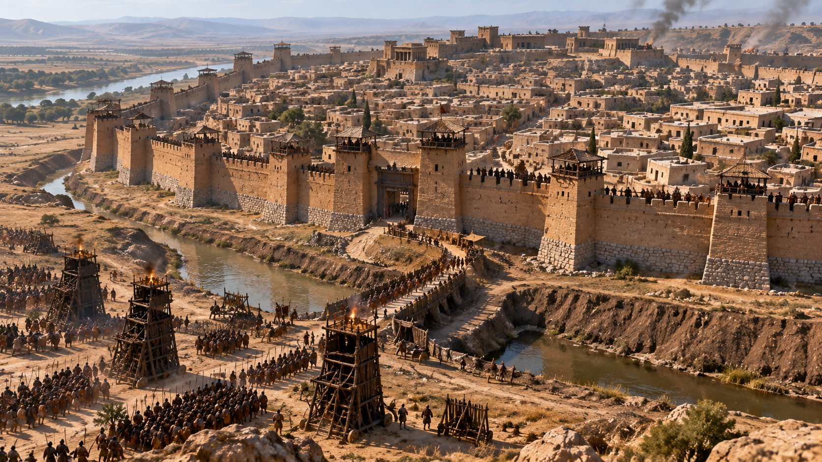
Other ancient fortifications used different solutions. At Ashkelon, archaeological work has documented massive ramparts, glacis systems, dry moats and monumental gates developed through successive phases. These structures demonstrate that ancient defensive engineering frequently relied on manipulating the attacker’s physical approach rather than merely building an enormous vertical wall. Slopes, ditches, gate structures and elevated defenses could work together to make the final approach slower and more dangerous. Harvard Museum of the Ancient Near East
The Street Maze Was Sometimes a Product of History
Not every winding ancient street should be interpreted as military architecture. Cities were living settlements, and their streets were frequently inherited from earlier periods rather than redesigned from scratch. A road that began as a path between houses could become a permanent street, while later buildings might be added around it instead of forcing the entire neighborhood into a geometric plan. Over generations, this process could produce an urban landscape that looked deliberately confusing even when no single planner had intended it to function that way. Cambridge University Press
Ancient Athens is a useful illustration of this broader phenomenon. The city developed over a long period and contained many irregular streets that followed the terrain, alongside important planned routes such as the Panathenaic Way. Its urban form was therefore a mixture of inherited pathways, major ceremonial routes and changing neighborhoods rather than a single unified design. The existence of a maze-like appearance does not by itself establish a military purpose. British Museum
This distinction matters because archaeology rarely preserves the intentions of planners in a perfectly readable form. Walls and streets survive physically, but the reasons why particular builders chose one alignment over another may have disappeared. Archaeologists must therefore combine architecture with chronology, terrain, written sources and evidence of conflict before concluding that a particular urban feature was designed for defense.
Ugarit and the Logic of Difficult Movement
The Late Bronze Age city of Ugarit on the Syrian coast offers another interesting example, although the evidence should be interpreted differently from Gordion. Archaeological research has reconstructed an unusually detailed street network in which many streets were narrow and contorted, creating a complex urban environment with multiple routes between locations. Researchers studying the city’s network have emphasized how the arrangement affected visibility, movement and social interaction. RCNi Company Limited
The Ugarit evidence does not establish that the city’s streets were deliberately designed as an anti-invasion maze. Its street network appears to have served everyday urban life, and the winding pattern may reflect the way the settlement developed over time. Yet the physical consequences of such a layout are relevant to the broader question of urban defense because restricted visibility and multiple alternative paths can make centralized surveillance and rapid movement more difficult. RCNi Company Limited
This is an important difference between evidence and interpretation. A city may possess characteristics that would complicate an invading army’s movement without those characteristics having been created specifically for that purpose. Ancient urban environments could simultaneously serve residents, merchants, officials and soldiers, and the same architectural feature could have different consequences for each group.
Pompeii Shows Why Context Matters
Pompeii provides another useful warning against simplistic interpretations. The city’s fortifications went through multiple phases, with archaeological evidence showing walls from different periods and substantial modifications before the Roman siege of 89 BCE. Excavations near the so-called Mercury Tower have revealed defensive walls, a path between them and multiple layers of roads, while twelve towers were associated with a major remodeling of the fortification system shortly before the siege. Pompeii Sites
Pompeii’s urban plan was also not uniformly irregular. Much of the city followed relatively regular street arrangements, while certain roads deviated because they followed older boundaries, terrain or earlier construction. The road between the Herculaneum Gate and the Forum, for example, followed an older wall line and became narrow and crooked in places. Its shape therefore illustrates how defensive history and urban growth could become physically entangled without every bend being intentionally created to confuse an attacker. Wikisource
The archaeological record becomes particularly revealing when the city’s streets are studied alongside the fortifications. Pompeii’s defensive system changed in response to political and military circumstances, and evidence from the Social War shows that the walls were actively involved in warfare. The lesson is that a city’s defensive character cannot always be read from its street map alone; walls, towers, gates, projectiles and construction phases may provide much stronger evidence of how the settlement was expected to withstand attack. Pompeii Sites
Confusion Was Only One Part of the Strategy
Making an attacker uncertain about direction was only one possible advantage of complex urban planning. Ancient defenders could also use narrow passages to prevent large groups from moving together, elevated positions to dominate streets, walls to divide an attacker from supporting troops and gates to force movement through controlled spaces. A well-designed defensive settlement could therefore turn movement itself into a series of obstacles. RCNi Company Limited
The basic principle was familiar from other forms of ancient warfare. A defender did not necessarily need to destroy an invading army immediately; delaying it could be strategically valuable. Every obstacle gave defenders more time to mobilize, while a narrow route reduced the usefulness of numerical superiority. A city that forced attackers to advance slowly through predictable corridors could make a much larger army behave like a series of smaller groups.
This helps explain why the strongest defensive urban systems often combined several features rather than relying on confusing streets alone. Walls created the outer barrier, towers provided observation and elevated attack positions, gates controlled access, and roads determined how people reached those gates. Terrain could reinforce every element by forcing an attacker uphill or into a restricted corridor. The city effectively became a three-dimensional defensive system.
Familiarity Was a Military Advantage
For defenders, an irregular city did not necessarily create the same confusion that it created for outsiders. Residents knew where streets connected, where gates opened and where alternative routes existed. Soldiers stationed inside the city could move through familiar spaces while an invading force had to rely on guides, captured information or visual landmarks. That asymmetry could become valuable during a siege or urban assault.
Aristotle’s observation captures precisely this difference. His argument was not that confusing streets were inherently good, but that a city should be easy for its own citizens to exit while being difficult for an enemy to approach and navigate. The ideal defensive arrangement therefore balanced accessibility for residents with obstacles for attackers. Perseus Digital Library
That principle remains one of the clearest ways to understand ancient defensive urbanism. The city was designed around different experiences depending on who was moving through it. A resident knew the shortcuts, a merchant knew the market routes, a soldier knew the defensive positions and an attacker saw an unfamiliar sequence of walls, turns and controlled entrances.
The Rise of the Grid Changed the Equation
The spread of regular urban planning created a different relationship between city design and defense. Orthogonal grids offered obvious practical benefits and became increasingly important in Greek and later Hellenistic settlements. Their streets could make movement, property division and civic organization more predictable, and the geometric structure could also communicate political order. MIT Press Open Arch & Urban Studies
That did not make grid-planned cities defenseless. A regular street system could exist behind formidable walls and sophisticated gates, while important roads could be positioned to support administration or military movement. The defensive advantage simply shifted toward other components of the urban system. Instead of relying primarily on uncertainty inside the city, planners could emphasize strong fortifications, controlled gates, strategic terrain and organized military positions.
Babylon illustrates how monumental urban planning could combine grandeur with defensive architecture. The city associated with Nebuchadnezzar II was surrounded by enormous walls and imposing gates, including the Ishtar Gate and the Processional Way. The architectural program expressed political and religious power as well as physical protection, showing that ancient fortifications could be simultaneously defensive structures, ceremonial spaces and statements of imperial authority. The Metropolitan Museum of Art
Why Ancient Cities Were Not All Designed as Mazes
The popular image of an ancient city deliberately constructed as a giant labyrinth is therefore misleading. Some settlements were irregular because they grew gradually, others were shaped by difficult terrain, and still others were deliberately organized according to geometric principles. Even within the same city, different neighborhoods could follow different patterns because they belonged to different phases of development.
What the evidence does support is more interesting than the simple maze theory. Ancient architects and military planners understood that controlling movement could make a settlement harder to attack, and they had multiple ways of achieving that goal. In the clearest cases, such as Gordion’s South Gate, archaeological evidence demonstrates that awkward approaches and changes of direction were deliberately incorporated into defensive architecture. RCNi Company Limited
The broader historical pattern is therefore one of selective complexity. Cities did not have to confuse every person who entered them; they needed to make military movement difficult at strategically important points. A narrow gate, an angled approach or a steep climb could accomplish more than an entire network of confusing streets if it forced an attacking army into a vulnerable position.
The City as a Weapon
Ancient cities are often imagined as passive backdrops to warfare, with the real action taking place outside their walls. Archaeology suggests a more complicated picture. The settlement itself could become an active component of defense, using architecture and geography to determine how an enemy approached, where troops could gather and how quickly they could move.
The most effective defensive design did not necessarily look spectacular from inside the city. A road that seemed inconvenient to a resident could be extremely useful if it forced an attacker to slow down before reaching a gate. A wall that appeared ordinary from a distance could become formidable when combined with a ditch, elevated ground and a controlled passage. The power of defensive architecture often came from the interaction between features rather than from any single monument. RCNi Company Limited
That is why the ancient city should be understood as a military landscape as well as a place of residence. Houses, streets, walls, gates, slopes and public spaces were connected within the same physical environment. When war came, ordinary urban features could acquire military significance, and the route that helped a resident reach home could become the route an enemy had to fight through.
Conclusion
Some ancient cities really were designed, at least in part, to make an attacker’s movement more difficult. Written evidence from Aristotle explicitly identifies irregular urban arrangements as useful because they could make it harder for foreign troops to enter and find their way around, while archaeological evidence from Gordion provides a particularly strong example of angled approaches deliberately built to slow an attacking force. Other cities show different combinations of walls, gates, slopes, moats and controlled routes that turned urban access into a defensive problem. Perseus Digital Library
But the idea should not be exaggerated into a universal rule. Ancient cities were complicated organisms that developed over centuries, and winding streets could result from terrain, inherited property boundaries, organic growth or earlier construction rather than a conscious desire to confuse invaders. The most convincing cases are those in which irregular movement is reinforced by clearly defensive architecture and, ideally, supported by archaeological or written evidence identifying the military purpose.
What makes these cities remarkable is not that their inhabitants built giant mazes. It is that they understood something fundamental about warfare: controlling how an enemy moves can be almost as important as stopping the enemy at the wall. A city could use distance, turns, elevation, narrow passages and unfamiliarity to transform the urban landscape into another layer of defense, forcing attackers to fight not only against soldiers and walls, but against the city itself.
FAQ
Did ancient cities really use confusing streets to stop invaders?
Yes, there is direct historical evidence that irregular urban layouts were understood as potentially useful during warfare. Aristotle wrote that the less regular arrangements associated with older cities could make it difficult for foreign troops to enter and find their way around during an attack. However, this does not mean that every ancient city with winding streets was intentionally designed for that purpose. Perseus Digital Library
Which ancient city provides strong evidence for confusing attackers?
Gordion in modern Turkey provides one of the clearest archaeological examples of defensive movement control. Its citadel South Gate had an approach road with two angled turns, and the archaeological publication states that these turns were intended to slow an attacking force. The route also incorporated substantial fortification walls, a glacis and a long uphill approach, making the entire entrance a controlled defensive corridor rather than a simple doorway. RCNi Company Limited
Why would winding streets help defend an ancient city?
Winding or irregular streets could make it harder for unfamiliar soldiers to maintain direction and move quickly through a settlement. Narrow passages could also restrict the number of troops able to advance together, while turns could prevent an attacker from seeing too far ahead. The defensive value depended heavily on the surrounding walls, gates, terrain and defenders rather than on confusing streets alone.
Were all ancient cities built as defensive mazes?
No. Ancient urban layouts developed for many different reasons, including terrain, property boundaries, religious structures, transportation, economic activity and gradual expansion. Some cities were highly regular and followed geometric grids, while others were much more irregular because they evolved over long periods. Archaeologists therefore need additional evidence before interpreting a winding street as a deliberate military feature. UChicago ISAC
What was the purpose of ancient city gates?
Ancient gates controlled access through defensive walls and could also serve as observation and fighting positions. Complex gate systems could force attackers through narrow or exposed routes, while towers and adjoining walls allowed defenders to control the approach. Excavations at Gordion and studies of Bronze Age fortifications such as Ashkelon demonstrate how gateways were integrated into larger defensive systems. RCNi Company Limited
Did ancient cities use terrain as part of their defenses?
Yes. Terrain could be incorporated into city defenses by placing settlements on elevated ground, forcing attackers uphill or using cliffs and slopes to make approaches more difficult. Gordion’s South Gate is a clear example because its approach road climbed toward the citadel while passing through controlled turns and fortified areas. Ancient fortification systems could therefore combine natural geography with walls and gates to create layered defenses. RCNi Company Limited
Was Pompeii’s irregular street layout designed to confuse invaders?
The evidence does not justify such a simple conclusion. Pompeii had substantial fortifications and underwent major defensive remodeling before the siege of 89 BCE, but parts of its street network were also shaped by earlier walls, terrain and the city’s long development. Its history demonstrates why archaeologists distinguish between a city’s defensive architecture and irregularities that arose through ordinary urban growth. Pompeii Sites
What did Aristotle say about ancient city planning and warfare?
Aristotle argued that regular straight streets were convenient for ordinary purposes, but that less regular arrangements could offer an advantage in wartime because foreign troops would have greater difficulty entering and navigating the city. He also suggested combining regular and irregular layouts rather than making the entire city disordered. His discussion is one of the clearest surviving ancient statements connecting urban design with military security. Perseus Digital Library
SOURCES & REFERENCES
- Aristotle, Politics, Book Seven — Perseus Digital Library. Primary ancient literary evidence for the relationship between street layout and military security. Perseus Digital Library — Aristotle, Politics
- American Journal of Archaeology — Fieldwork at Phrygian Gordion, 2016–2023. Detailed archaeological evidence for Gordion’s gates, angled approach roads, fortifications and defensive planning. American Journal of Archaeology — Gordion Fieldwork
- MIT Press — Orthogonal Town Planning in Antiquity. Scholarly treatment of ancient urban planning and the distinction between regular and irregular city layouts, including discussion of Aristotle and Hippodamus. MIT Press — Orthogonal Town Planning in Antiquity
- Pompeii Sites — Pompeii’s Fortifications. Archaeological information on the city’s defensive walls, towers, roads and remodeling before the Social War. Pompeii Sites — Pompeii’s Fortifications
- Harvard Museum of the Ancient Near East — Ashkelon 6. Archaeological research on Bronze Age ramparts, gates, glacis systems and fortifications at Ashkelon. Harvard Museum of the Ancient Near East — Ashkelon 6
- Cambridge University Press — A Mesoamerican Urban Road Network: An Analysis of Pedestrian Pathways of Angamuco. Scholarly analysis demonstrating how complex ancient road networks affected accessibility and urban movement. Cambridge University Press — Angamuco Urban Road Network
- Metropolitan Museum of Art — Babylon. Institutional overview of Babylon’s monumental walls, gates and Processional Way. The Metropolitan Museum of Art — Babylon